top of page
  • Perfectly portable

  • Great for Scouting

  • Amazing photo & video

  • Mapping Capability

m3m.png

At LandView, we specialize in offering farm-ready drone packages designed to meet your farm needs

Interested in a quote? 

Mavic 3 Multispectral
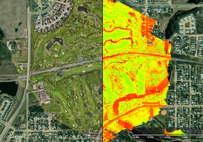
Mapping Grid Line.png

Mapping Capability

Multispectral icon website.png

Multispectral sensor

Mapping provides detailed aerial data for crop health assessment, irrigation planning, and more

captures data across various wavelengths, providing detailed insights into crop health and environmental conditions with unparalleled precision

omnidirectional icon.png

 Obstacle Detection

Ensuring comprehensive situational awareness from all angles making this drone extremely user friendly

zoom ortho and TGI.png

Contact

PO BOX 1140, Camrose, AB T4V 4E7

(780) 448-7445

info@landview.com
  • Facebook
  • Twitter
  • LinkedIn
  • Instagram

Thanks for submitting!

bottom of page