top of page
Bruce Phos: Alpine Plots in NDVI

Bruce Phos Yard
Bruce Location
Alliance Location
Click on the images above to open a map of the location. If you have the GPS on your smartphone enabled, it will show your location on the map with a blue dot.
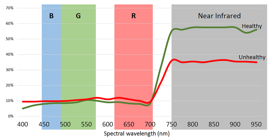
NDVI (normalized difference vegetation index) uses false colours to show differences in crop growth & crop health. Generally, red areas are thin crop or unhealthy crop. But that is not always the case, so NDVI is a tool that complements ground truthing by an agronomist.
Want more info? Talk to Robin Harrison about the details of his drone service and the interpretation of NDVI imagery.


Interested in purchasing your own drone package? Talk to Robin about his DJI Inspire or AgEagle, or the other products offered by LandView Drones in Edmonton.
Robin Harrison
Viking, AB
bottom of page


