top of page
Worsley crops ...
as seen by AgEagle
Flown using a modified 20 MP camera that filters out red wavelengths and adds near infrared light. Produces a reddish image.

NDVI (normalized difference vegetation index) uses false colours to show differences in crop growth & crop health. Generally, red areas are thin crop or unhealthy crop.

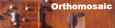
The AgEagle can also produce detailed digital terrain models of your fields, or it can be used for other surveying work.

Sometimes incredibly useful (for demonstrative purposes in surface land disputes, for example) ... but always cool. The AgEagle system creates 3D models automatically after the flight.
NOTE: The full model may take a few minutes to load.

bottom of page